
Exploring the Charlton-King-Vandam Historic District Through Maps, Images, and Memory
Since 1980, Village Preservation has worked tirelessly to preserve, protect, and advocate for the historic, cultural, and architectural heritage of Greenwich Village, the East Village, and NoHo. And while the boundaries of our neighborhoods are mostly pretty easy to define, stretching from the East River to the Hudson River, and from 14th Street to Houston Street, there are some notable exceptions on the west side, which includes the Sullivan-Thompson Historic District and the Charlton-King-Vandam Historic District.
The Sullivan-Thompson Historic District is part of the South Village Historic District (as defined by the State and National Registers of Historic Places, as well as our original proposed South Village Historic District) and was not landmarked until December 13th, 2016. The area is one of the first historic districts in New York City to be designated almost exclusively based upon its immigrant history and working-class architecture. The other exception, however, has a much longer history of landmark protection. Just a few blocks west, the Charlton-King-Vandam Historic District was designated 50 years earlier, on August 16, 1966.
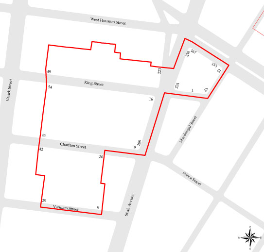
The tiny Charlton-King-Vandam neighborhood is, as its name would imply, located along charming Charlton, King, and Vandam Streets, between Sixth Avenue and Varick Street, with a little arm extending up the southernmost block of MacDougal Street just below Houston Street. It was only the fourth designated historic district in New York City. And while small, the district is chock-full of historic significance. Village Preservation offers a myriad of resources and tools to inform the public about the culture and history of our neighborhoods. Today, we are exploring some of those resources through the lens of the Charlton-King-Vandam Historic District.
Village Preservation offers a myriad of resources and tools to help anyone learn more about the history of our neighborhoods, whether you’re interested in a particular street, building, architectural style, historic period, or the people and communities who have called these neighborhoods home. Our Resources section makes it easy to dive deeper into any corner of Greenwich Village, the East Village, and NoHo and discover the stories that make each one unique. Today we’re taking a look at just a few of these resources to better understand the Charlton-King-Vandam Historic District.
Revolutionary War Map
Like much of our neighborhoods, the Charlton-King-Vandam Historic District has deep ties to our country’s fight for independence. In June 2026, Village Preservation released the Revolutionary War Story Map, depicting the many ways our neighborhoods played a role in the Revolutionary War, from military headquarters and battle sites to the homes of those who lived through the conflict.
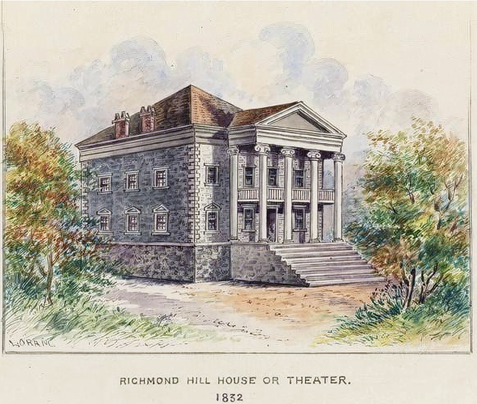
Long before the district became what we know it as today, it was home to Richmond Hill. Constructed in 1767 for Major Abraham Mortier, the home stood atop a grand 400-foot-high hill and was built in the Palladian style, featuring a prominent portico supported by Ionic columns. By 1776, the Richmond Hill mansion became George Washington’s headquarters as he strategized against an impending attack from the British. While at Richmond Hill, from April to August 1776, Washington wrote every day to various generals, lieutenants, and John Hancock, the President of the Continental Congress at the time.
As described in the Revolutionary War Map, Washington and his troops remained headquartered at Richmond Hill until they were routed by the Redcoats at the Battle of Brooklyn and forced to abandon the city, which remained under British occupation for seven years until the end of the war.

Richmond Hill consisted of some 26 acres of land in the countryside and had served its owners as an escape from the city to the south on the island of Manhattan. Located on an elevated site with views of the Hudson River, the property was notable for its natural beauty.
At one point or another, both John Adams and Aaron Burr owned and resided in Richmond Hill. Burr purchased Richmond Hill in 1794, and it was where he lived at the time of his notorious duel with Alexander Hamilton in 1804. After Burr fled New York following the duel, the property was acquired by John Jacob Astor. Astor developed the land, which today forms much of the Charlton-King-Vandam Historic District plus the southernmost block of MacDougal Street.
Before fleeing, though, Burr mapped out Richmond Hill into lots of 25 by 100 feet on Charlton, King, and Vandam Streets. In his original plans, Burr named what is now Charlton Street for himself, dubbing it Burr Street. King Street was named for Rufus King, a fellow U.S. senator, and Vandam for Anthony Van Dam, a wealthy importer and city alderman. Lack of finances stopped Burr’s plans from coming to fruition and allowed John Astor to develop the neighborhood into what we know it as today.
Greek Revival Map
After the Revolutionary War, our neighborhood experienced significant growth, both in population and in architecture. By the early 1800s, the Richmond Hill mansion had been moved to the corner of Charlton and Varvick Streets, where it remained and operated as a theater for many years, while the majestic hilltop it had originally sat on was leveled, making way for new development. Thus, a series of Federal rowhouses popped up on the former estate.

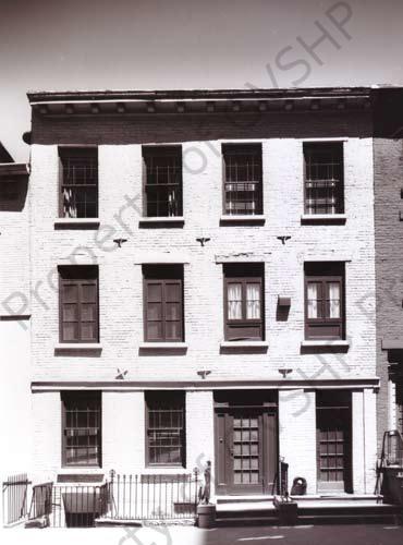
And many of those homes remain standing today. Those lost from house fires were swiftly replaced by Greek Revival homes starting in the 1830s and 40s. The neighborhood now has the highest concentration of Federal and Greek Revival homes in all of New York City. Village Preservation’s Guide to Greek Revival Architecture shows several examples of these homes. One notable example is found at 43 MacDougal Street.
This 1846 Greek Revival townhouse suffered from devastating neglect for over a decade, from the 1990s through the early 2000s. During that time, Village Preservation pushed both the absentee owner and the City to take action to save the deteriorating landmark, including calling for a “demolition by neglect” lawsuit to force restoration. A new owner made an earnest and diligent effort to renovate the building and, in the spring of 2014, began the process of bringing the long-neglected building back to its original glory. In addition to the restoration of the Greek Revival details on the facade, a handsome storefront was added with similar details.
Village Preservation’s Historic Image Archive and Preservation History Archive, Evelyn Haines Collections
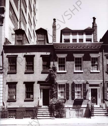
Evelyn Haines (1909-2001) was a preservationist, a former editor of Vogue, and a member of the New York City Landmarks Preservation Commission in its earliest days. Within our vast Historic Image Archive is a collection of her photographs, many of which capture the architecture and character of the Charlton-King-Vandam Historic District.
Within our Neighborhood/Preservation History Archive, The Evelyn Haynes Collection (Parts 1&2) focuses on photographs, sketching, writings, and historic materials connected to Greenwich Village, the Charlton-King-Vandam district, and Lower Manhattan, especially Federal (ca. 1790-1835) and Greek Revival (ca. 1830-1850) row houses and architecture in this area.
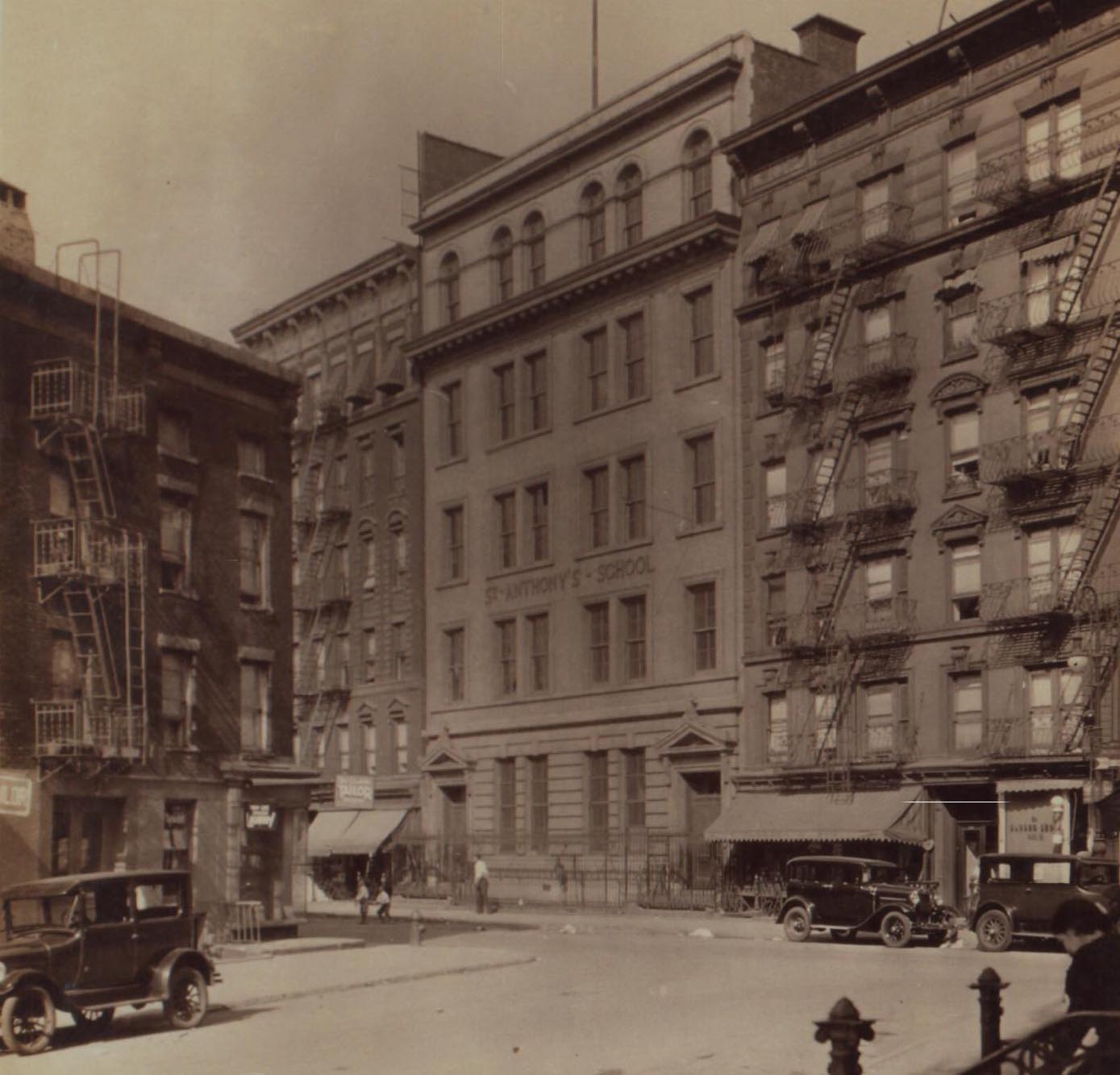
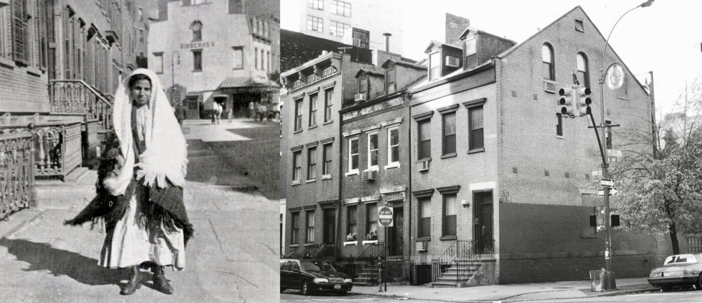
Our Center for Migration Studies Collection of our Historic Image Archive also have some great images of the Charlton-King-VanDam Historic District from the late 19th and early 20th centuries, when like the rest of the South Village it was an epicenter of Italian immigration to New York. And our various Susan DeVries historic image archive collections (Federal Rowhouses in Lower Manhattan Part I and Part II, and Architecture in Lower Manhattan) has several wondefuly images of houses in the district taken in the 1990s when preservation efforts in Lower Manhattan were amping up again, particularly around the kinds of Federal Houses and Greek Revival architecture in which this district is so rich.
The Charlton-King-Vandam Historic District may be small, but as these resources show, there is no shortage of history to uncover. Explore our resources page and explore our maps, Image Archive, oral histories, archive of programs, and more!