

← View All


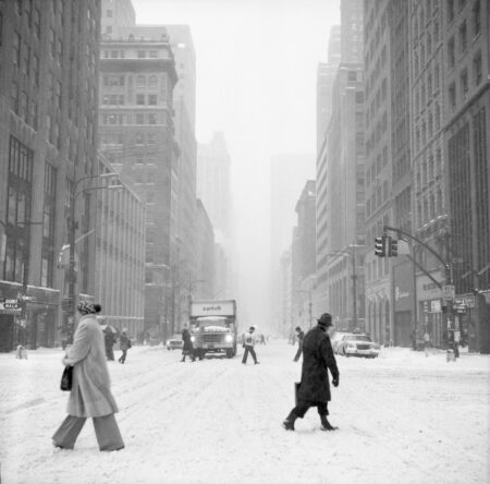


Image Tag: Street Scenes
Bleecker Street looking east from between Sullivan and MacDougal Streets
Bleecker Street via Google Streetview.
Bleecker and MacDougal Street
Bleecker and MacDougal Street via Google Streetview.
Looking northeast across the intersection of Broadway and 12th Streets
Broadway and 12th Street via Google Streetview.
South side of Morton Street between Hudson and Bedford Streets
Morton Street via Google Streetview.
Sheridan Square with Village Cigars
Sheridan Square via Google Streetview.
‘Häagen Dazs’ at 30 West 8th Street at MacDougal Street
30 West 8th Street via Google Streetview.
Two Women on the south side of Broadway and 12th Street
Broadway and 12th Street via Google Streetview.
Waverly Place looking west across Sixth Avenue in the rain
Sixth Avenue and Waverly Place via Google Streetview.
East side of Sixth Avenue, south of Waverly Place
Sixth Avenue and Waverly Place via Google Streetview.
Vendors on Sixth Avenue east side, looking south from 8th Street
6th Avenue and 8th Street via Google Streetview.
32-34 West 34th Street Fire, streetscape
34th Street via Google Streetview.
Looking west across Lafayette Street along Astor Place
Lafayette Street and Astor Place via Google Streetview.
Astor Place and Cooper Square
Astor Place and Cooper Square via Google Streetview.
Looking through a window northwest across Seventh Avenue South at Grove Street
Grove Street via Google Streetview.
Café Figaro at the southeast corner of MacDougal and Bleecker Streets 1
Café Figaro at MacDougal and Bleecker via Google Streetview.
Café Figaro at the southeast corner of MacDougal and Bleecker Streets 2
Café Figaro at MacDougal and Bleecker via Google Streetview.
Café Figaro at the southeast corner of MacDougal and Bleecker Streets 3
Café Figaro at MacDougal and Bleecker via Google Streetview.
Looking east on West 3rd Street across LaGuardia Place, NYU Bobst Library barely visible in background
64 West Third Street via Google Streetview.
West 8th Street at MacDougal Street looking north in 1978 Blizzard
West 8th Street at MacDougal via Google Streetview.
Looking north on Minetta Street to Minetta Lane
Minetta Street via Google Streetview.
Minetta Street looking north
Minetta Street via Google Streetview.
(l. to r.) 276-286 Grand Street
276-286 Grand Street via Google Streetview.
284 Grand Street
284 Grand Street via Google Streetview.
(r. to l.) 503-519 Grand Street, streetscape
503-519 Grand Street via Google Streetview.
(l. to r.) 502, 504, 506, 508 Canal Street, 1998
Now landmarked, these houses date to from between 1819 and 1841.
South side of Bleecker Street between Bowery and Elizabeth
These buildings were landmarked with Village Preservation’s support as part of the NoHo East Historic District in 2003. Via Google Streetview.
East side of Washington Street north of Gansevoort Street
This row of Meatpacking buildings were built in the 1880s by John Jacob Astor III and altered to their current height in 1940. Village Preservation got these and surrounding buildings landmarked in 2003 as part of the Gansevoort Market Historic District, and listed on the State and National Registers of Historic Places in 2007. Washington Street via […]
(l. to r.) 10-18 Gay Street
14 Gay Street was landmarked as part of the Greenwich Village Historic District in 1969, and made famous by author Ruth McKenna, who lived in the basement apartment and described her time there in the book and film “My Sister Eileen,” which became the basis for the Broadway show and movie “Wonderful Town.” In 2022 […]
14th Street and Ninth Avenue Meatmarket, (2000)
Village Preservation proposed and secured landmark designation for the Gansevoort Market Historic District, including all the buildings seen on the west side of 9th Avenue and 14th Street, in 2003, and got the district listed on the State and National Registers of Historic Places in 2007. 14th Street and Ninth Avenue via Google Streetview.
(l. to r.) 40-52 Carmine Street streetscape
Built 1827-28, 42, 44, and 46 Carmine Street and their surroundings were landmarked as part of the Greenwich Village Historic District Extension II (South Village) which Village Preservation advocated for in 2010. Through Village Preservation’s efforts, it was also listed on the State and National Registers of Historic Places in 2013. 42-46 Carmine Street via […]
(l. to r.) 40-48 Carmine Street
Built 1827-28, 42, 44, and 46 Carmine Street are Federal-style houses landmarked along with their surroundings in 2010 as part of the Greenwich Village Historic District Extension II (South Village) that Village Preservation proposed and fought for. Through Village Preservation’s efforts, it was also listed on the State and National Registers of Historic Places in […]
(l. to r.) 59, 57, and 55 Sullivan Street
Built in 1816-17, 57 Sullivan Street is one of 13 federal style houses in Lower Manhattan which Village Preservation and the NY Landmarks Conservancy proposed for landmark designation in 2002. It is among the 10 of the 13 which were landmarked, designated as both an individual landmark and as part of Sullivan Thompson Historic District […]
(l. to r.) 502-508 Canal Street, 1995
Now landmarked, these houses date to from between 1819 and 1841.
(l. to r.) 284, 280 Hudson Street
Built ca. 1820. 280, 284 Hudson Street via Google Streetview.
(l. to r.) 502, 504, 506, 508 Canal Street, 1995 Streetscape
Now landmarked, these houses date to from between 1819 and 1841.
(l. to r.) 130, 132, 134 Sullivan Street, streetscape
…by Village Preservation) in 2013. Through Village Preservation’s efforts, they were also listed on the State and National Registers of Historic Places in 2013. 134 Sullivan Street via Google Streetview….
58 Bleecker Street, looking down Crosby Street
Built 1822-23 by James Roosevelt, great grandfather of Franklin Delano Roosevelt, this federal house was landmarked in 1999 as part of the NoHo Historic District designation. In 2018 Village Preservation placed a plaque on the building marking its service as home to the first hospital run by and for women, led by Elizabeth Blackwell, the first […]
67 Greenwich Street (at Edgar Street)
Built 1809-10, this is one of 13 federal style houses in Lower Manhattan which Village Preservation and the NY Landmarks Conservancy proposed for landmark designation in 2002. It is among the 10 of the 13 which were landmarked, designated as an individual landmark in 2005. 67 Greenwich Street via Google Streetview.
48-50 Henry Street
By the time these pictures had been taken, the ca. 1832 federal houses previously located on this site had been demolished. View of the houses pre-demolition ca. 1980 from NYC tax photos. 48-50 Henry Street via Google Streetview.
(r. to l.) 38, 36, 34, 32, 30 Dominick Street, Streetscape
Built in 1826, 36, 34, and 32 Dominck Street were among twelve Federal style brick row houses built on the south side of Dominick Street between Hudson and Varick Streets, just four of which survived (38 is highly altered). They were landmarked in 2012. 32 Dominick Street via Google Streetview.
South Street Seaport, 207 Water Street Warehouses
This collection of images shows the South Street Seaport area before its restoration and rebuilding in the 1980s, when many of these buildings that were among the oldest in New York and an important record of the city’s maritime roots were in a rundown or dilapidated condition.
North side of West 8th Street East from 6th Avenue, with El, 1935 NYPL Photograph
1935 empty lot at the southeast corner of Sixth Avenue and West 8th Street.
The Cable Building, 1910
For more information on the application to the Landmarks Preservation Commission associated with this image, click here.
The Cable Building from Broadway and Houston Street, 1932-34
For more information on the application to the Landmarks Preservation Commission associated with this image, click here.
314 Bleecker Street, 1940s Tax Photo
For more information on the application to the Landmarks Preservation Commission associated with this image, click here.
The Cable Building, 1892
For more information on the application to the Landmarks Preservation Commission associated with this image, click here.
View of Houston Street looking west from Mulberry Street, with the Cable Building visible at right, 1933
For more information on the application to the Landmarks Preservation Commission associated with this image, click here.
182 Spring Street, 1940s Tax Photo
For more information on the application to the Landmarks Preservation Commission associated with this image, click here.
396 and 398 West Street (l. to r., still extant), along with the rest of West Street north of 10th Street to Charles Lane, 1927
For more information on the application to the Landmarks Preservation Commission associated with this image, click here.
Southwest corner of Spring and Thompson Streets, 1901
For more information on the application to the Landmarks Preservation Commission associated with this image, click here.
(l. to r.) 21, 23, 25, 27 8th Avenue Tax Photo, 1940
For more information on the application to the Landmarks Preservation Commission associated with this image, click here.
A Biker and a Skater take advantage of the Empty Street Post Attack, Looking South from West Broadway and North Moore Street
Professional photographer Robert A. Ripps took these images of the World Trade Center on September 11, 2001, and of Ground Zero and its surroundings in the days and weeks following 9/11.
An Unknown Artist Captures the Scene Near Greenwich and Duane Streets as Fellow New Yorkers Pass
Professional photographer Robert A. Ripps took these images of the World Trade Center on September 11, 2001, and of Ground Zero and its surroundings in the days and weeks following 9/11.
Hospital Workers Pass Dry Cleaner and Parking Lot on Greenwich Street
Professional photographer Robert A. Ripps took these images of the World Trade Center on September 11, 2001, and of Ground Zero and its surroundings in the days and weeks following 9/11.
Mack Truck Driving Up Greenwich Street North of Warren Street with Emergency Workers and Onlookers Walking Past
Professional photographer Robert A. Ripps took these images of the World Trade Center on September 11, 2001, and of Ground Zero and its surroundings in the days and weeks following 9/11.
New Yorkers Witness The Smoking Wreckage on Greenwich Street at Duane Street
Professional photographer Robert A. Ripps took these images of the World Trade Center on September 11, 2001, and of Ground Zero and its surroundings in the days and weeks following 9/11.
Packages and Supplies Outside Bubby’s on Hudson Street
Professional photographer Robert A. Ripps took these images of the World Trade Center on September 11, 2001, and of Ground Zero and its surroundings in the days and weeks following 9/11.
Pedestrians and a Postal Service Truck Outside Chris French Cleaners on East 9th Street and Fourth Avenue, with an American Flag Above
Professional photographer Robert A. Ripps took these images of the World Trade Center on September 11, 2001, and of Ground Zero and its surroundings in the days and weeks following 9/11.
Traffic on the West Broadway is Quiet as a Biker and Skater Move Towards a Lone Car in Motion, With Ground Zero in the Distance
Professional photographer Robert A. Ripps took these images of the World Trade Center on September 11, 2001, and of Ground Zero and its surroundings in the days and weeks following 9/11.
Looking South on Fifth Avenue Towards the Smoke Rising at Ground Zero
Professional photographer Robert A. Ripps took these images of the World Trade Center on September 11, 2001, and of Ground Zero and its surroundings in the days and weeks following 9/11.
New Yorkers Watch in Disbelief as Tower 1 Burns
Professional photographer Robert A. Ripps took these images of the World Trade Center on September 11, 2001, and of Ground Zero and its surroundings in the days and weeks following 9/11.
Huge Crowds Stand on the Corner of Greenwich and Chambers, Looking South Towards the Destruction at Ground Zero
Professional photographer Robert A. Ripps took these images of the World Trade Center on September 11, 2001, and of Ground Zero and its surroundings in the days and weeks following 9/11.
New Yorkers Gather Alongside Traffic Watching Towers Burning as seen from Bleecker Street and 6th Avenue (6)
A Village resident documented 9/11 and the World Trade Center from the streets of Greenwich Village.
Barricades and a Makeshift Memorial at Chambers and Greenwich Streets, with only Residents Allowed Past
Professional photographer Robert A. Ripps took these images of the World Trade Center on September 11, 2001, and of Ground Zero and its surroundings in the days and weeks following 9/11.
Crowds of New Yorkers and Pedestrians in Road at Chambers and Greenwich Streets
Professional photographer Robert A. Ripps took these images of the World Trade Center on September 11, 2001, and of Ground Zero and its surroundings in the days and weeks following 9/11.